Field: Technology
Alaska's monster tsunami sent water 1,580 feet up a mountain
Published | Technical Staff
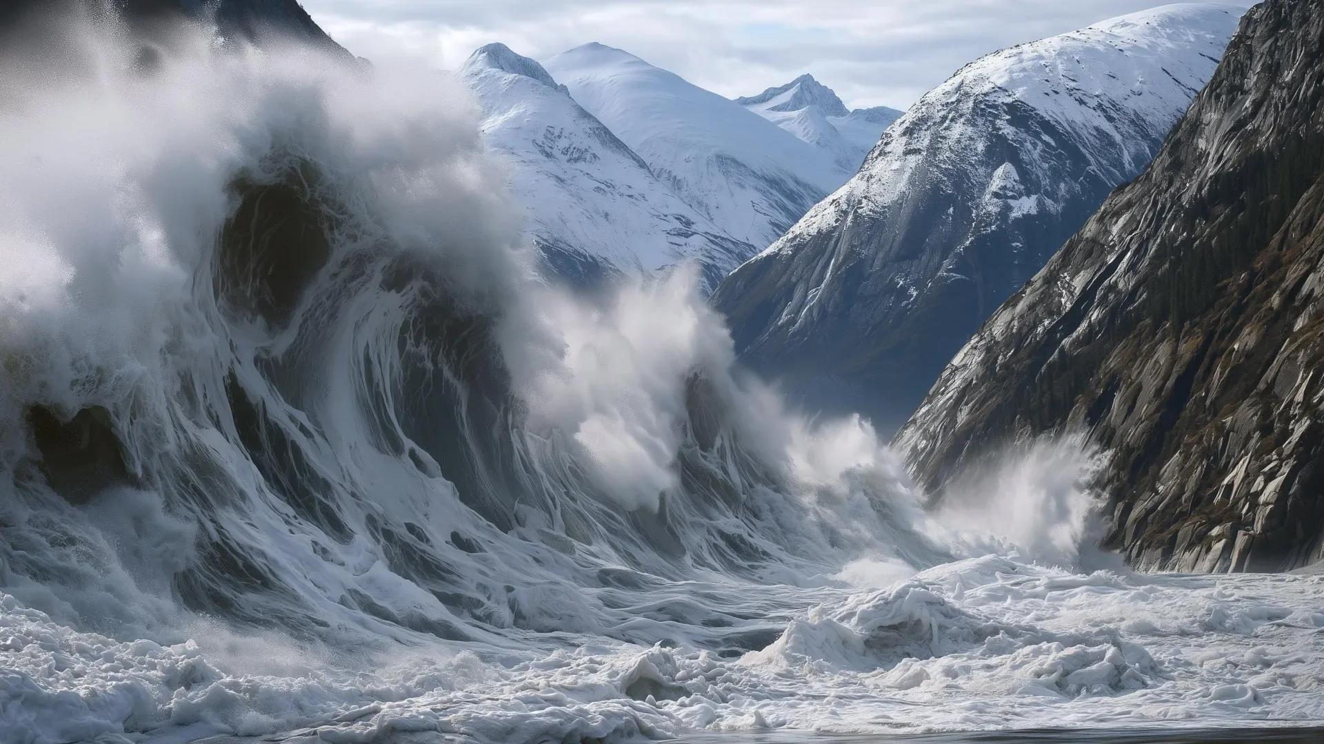
Visualization
The unassuming beauty of Alaska's fjords belies a perilous dynamism that has recently captured the attention of scientists worldwide. On a fateful August morning in 2025, tourists aboard the Hanse Explorer departed the South Sawyer Glacier, blissfully unaware that their picturesque surroundings were teetering on the brink of disaster. Just twelve hours later, momentum was unleashed as the adjacent mountain succumbed to a massive landslide, spawning a cataclysmic tsunami that would send water surging 1,580 feet—higher than the iconic Taipei 101 skyscraper—up the opposite mountainside. This event marked the second-highest tsunami ever documented, a stark reminder of nature’s omnipotent forces.
Researchers affiliated with the Alaska Earthquake Center, including state seismologist experts, presented findings on this unprecedented geographical upheaval, underscoring the intertwined relationship between climate change and geological stability. As glacial retreat accelerated, marked by atmospheric warmth and anomalous precipitation, the instability of coastal mountains grew increasingly perilous. The comprehensive analysis elucidated how multifaceted factors contributed to the landslide's initiation and subsequent tsunami propagation. The glacial face was subject to rapid calving—a phenomenon characterized by the fracturing and breaking of ice masses—while seismic activity in the days preceding the event signaled shifting geological conditions. Thousands of small tremors acted as harbingers of impending instability, yet this information remained unheeded due to the absence of an effective monitoring program.
In the preceding months, the glacier had receded dramatically, withdrawing over 0.5 kilometers from its previous terminus. With increased rainfall saturating the rock formations, hydraulic pressure intensified within the fractures—a common trigger for slope failure in geological contexts. The cumulative effects of rapid glacial retreat combined with the erosive processes induced by heavy precipitation distilled the region's latent dangers, with the landslide serving as a potent example of what lies ahead for other similar coastal ecosystems.
The mechanics behind the cascade of events remain only partially understood but demonstrate a clear correlation: as glaciers recede, slopes appear to lose their stability. This emerging pattern is being replicated not just in Alaska, but across diverse Arctic geographies extending from Greenland to Norway, where ancient ice is now yielding to modern warming. Countries in the Arctic are grappling with a growing number of landslide-triggered tsunamis, ultimately crafting a complex interplay between climate change and coastal safety.
Recognizing this pattern could pave the way for the development of robust alert systems, enabling proactive responses to geological hazards. The potential for generating effective warning systems hinges on improved comprehension of the geological precursors to landslides, as exemplified by the cry of alarm raised by the Tracy Arm disaster. The combination of meteorological conditions, including intensified rainfall and glacier instability, could usher in a framework for alert notifications, ideally translating geological anomalies into actionable intelligence.
Had such monitoring systems been in place in August 2025, progressive alerts might have been issued, cautioning both mariners and coastal communities about the elevated risks. A tiered alert system, akin to those deployed for natural disasters, could bolster situational awareness. A yellow alert might have been issued for generalized elevated risk, whereas a shift to an orange alert—triggered by the exponential increase in seismic activity—would have prompted a precise warning for those in immediate danger. In the event of a detected landslide, rapid seismic wave transmission could facilitate warning systems capable of issuing a red alert, alerting nearby vessels to divert.
The inability to deliver timely warnings compounds the threat posed by natural disasters. In the aftermath of the Tracy Arm incident, cruise lines prudently altered their itineraries to avoid the dangerous fjord. Yet the allure of these landscapes—where dynamic geology meets mesmerizing glacial vistas—ensures that human curiosity will continue to draw visitors to such regions. Therefore, the focus must not be on evading these natural wonders but on fostering a culture of awareness and preparedness.
Cohesive efforts among state and federal agencies are paramount in constructing a feasible landslide monitoring framework. Although real-time data acquisition and dissemination could yield crucial seconds or minutes of warning, it remains an imperfect solution. The objective is to mitigate, rather than eliminate, risk. As the data gleaned from the Tracy Arm landslide emphasizes, understanding these hazards is integral to implementing preventative measures. An integrated monitoring system would provide the crucial parameters needed to discern patterns of instability and trigger timely caution alerts.
The challenges posed by both nature and human activity compel a re-evaluation of our relationship with these majestic, yet volatile environments. As we stand on the precipice of evolving landscapes influenced by accelerating climate change, the lessons from upturned rock and surging tides in Alaska should resonate globally. Only through vigilant observation, interdisciplinary cooperation, and proactive communication channels can society forge ahead amidst the beautiful but treacherous complexities of our changing planet.
Researchers affiliated with the Alaska Earthquake Center, including state seismologist experts, presented findings on this unprecedented geographical upheaval, underscoring the intertwined relationship between climate change and geological stability. As glacial retreat accelerated, marked by atmospheric warmth and anomalous precipitation, the instability of coastal mountains grew increasingly perilous. The comprehensive analysis elucidated how multifaceted factors contributed to the landslide's initiation and subsequent tsunami propagation. The glacial face was subject to rapid calving—a phenomenon characterized by the fracturing and breaking of ice masses—while seismic activity in the days preceding the event signaled shifting geological conditions. Thousands of small tremors acted as harbingers of impending instability, yet this information remained unheeded due to the absence of an effective monitoring program.
In the preceding months, the glacier had receded dramatically, withdrawing over 0.5 kilometers from its previous terminus. With increased rainfall saturating the rock formations, hydraulic pressure intensified within the fractures—a common trigger for slope failure in geological contexts. The cumulative effects of rapid glacial retreat combined with the erosive processes induced by heavy precipitation distilled the region's latent dangers, with the landslide serving as a potent example of what lies ahead for other similar coastal ecosystems.
The mechanics behind the cascade of events remain only partially understood but demonstrate a clear correlation: as glaciers recede, slopes appear to lose their stability. This emerging pattern is being replicated not just in Alaska, but across diverse Arctic geographies extending from Greenland to Norway, where ancient ice is now yielding to modern warming. Countries in the Arctic are grappling with a growing number of landslide-triggered tsunamis, ultimately crafting a complex interplay between climate change and coastal safety.
Recognizing this pattern could pave the way for the development of robust alert systems, enabling proactive responses to geological hazards. The potential for generating effective warning systems hinges on improved comprehension of the geological precursors to landslides, as exemplified by the cry of alarm raised by the Tracy Arm disaster. The combination of meteorological conditions, including intensified rainfall and glacier instability, could usher in a framework for alert notifications, ideally translating geological anomalies into actionable intelligence.
Had such monitoring systems been in place in August 2025, progressive alerts might have been issued, cautioning both mariners and coastal communities about the elevated risks. A tiered alert system, akin to those deployed for natural disasters, could bolster situational awareness. A yellow alert might have been issued for generalized elevated risk, whereas a shift to an orange alert—triggered by the exponential increase in seismic activity—would have prompted a precise warning for those in immediate danger. In the event of a detected landslide, rapid seismic wave transmission could facilitate warning systems capable of issuing a red alert, alerting nearby vessels to divert.
The inability to deliver timely warnings compounds the threat posed by natural disasters. In the aftermath of the Tracy Arm incident, cruise lines prudently altered their itineraries to avoid the dangerous fjord. Yet the allure of these landscapes—where dynamic geology meets mesmerizing glacial vistas—ensures that human curiosity will continue to draw visitors to such regions. Therefore, the focus must not be on evading these natural wonders but on fostering a culture of awareness and preparedness.
Cohesive efforts among state and federal agencies are paramount in constructing a feasible landslide monitoring framework. Although real-time data acquisition and dissemination could yield crucial seconds or minutes of warning, it remains an imperfect solution. The objective is to mitigate, rather than eliminate, risk. As the data gleaned from the Tracy Arm landslide emphasizes, understanding these hazards is integral to implementing preventative measures. An integrated monitoring system would provide the crucial parameters needed to discern patterns of instability and trigger timely caution alerts.
The challenges posed by both nature and human activity compel a re-evaluation of our relationship with these majestic, yet volatile environments. As we stand on the precipice of evolving landscapes influenced by accelerating climate change, the lessons from upturned rock and surging tides in Alaska should resonate globally. Only through vigilant observation, interdisciplinary cooperation, and proactive communication channels can society forge ahead amidst the beautiful but treacherous complexities of our changing planet.